A0From €1,200 excl. VAT
Territorial data framing workshop
An inventory of the data available and of the gaps, three priority use cases ranked, a summary note with an effort estimate.
The packages
Short engagements, two to six weeks. Deeper ones, four weeks to six months. The figures shown are floors: they match the simplest form of each package, one perimeter, one grid, one set of sources. All of them sit under the French direct-award threshold for public buyers, except the delivered platform, priced case by case.
Tier 1 · two to six weeks
One perimeter, one question, one dated deliverable. These are the entry formats: quick to order, readable in a single sitting.
An inventory of the data available and of the gaps, three priority use cases ranked, a summary note with an effort estimate.
Two maps: the balance of openings and closures by 150 m blocks, and closure density by street segment. A summary note, three priority streets with the reasoning, data delivered as GeoJSON.
Ordered directly, with no prior advertising or tender.
Twelve to fifteen before-and-after indicators, output maps, a reusable dashboard, a write-up that works in a project committee.
Audit of the existing grid, go and no-go criteria rewritten and weighted, a summary note, one investment committee slide.
A weighted criteria grid built together in a workshop, zones scored from 0 to 100, an interactive map delivered, ten to fifteen priority zones with their justification, one summary slide.
All of these formats sit under the direct-award thresholds for public buyers: €60,000 excl. VAT in France, €15,000 excl. VAT in Spain.
Tier 2 · four weeks to six months
For when a note will not settle the question: a foundation to install, a method to hand over, or a direction to hold over time.
Bounded engagements, each with its deliverable and its timescale.
Ordered directly, with no prior advertising or tender.
In Spain, the perimeter is adjusted to €14,500 excl. VAT to stay within the contrato menor.
A documented data foundation, a WebGIS to consult and, where needed, to edit, usable without GIS skills, dashboards set to your priorities, two half-days of training, handover documentation.
Set up on your own infrastructure or on a public cloud; hosting and maintenance priced separately.
Hosting and maintenance outside the package, no licence bought or passed on, no Esri migration.
Ordered directly, with no prior advertising or tender.
A documented multi-criteria model, two or three scenarios compared, an interactive dashboard, qualified sites or prospects, the method handed over.
Ordered directly, with no prior advertising or tender.
A testable PRD, scope arbitrated in batches, a revenue model and the free / paid boundary, a test protocol with decision thresholds, a prioritised backlog.
Ordered directly, with no prior advertising or tender.
A picture of the data, the tools and the real usage, a reasoned target architecture, a hiring or outsourcing plan, a three-page note that works in a committee.
Ordered directly, with no prior advertising or tender.
A source audit, a documented data model, an automated loading chain in PostgreSQL and PostGIS, quality checks, handover documentation, a half-day of transfer. For public bodies, housing providers and companies.
Hosting and maintenance outside the package, no licence bought or passed on, no Esri migration.
Above €60,000 excl. VAT, a French public order moves to a formal procedure. These formats are not sized for that.
For when the engagement calls for a tool that does not exist yet: I design the data, the method and the product framing, application development included. Priced case by case.
Set up on your own infrastructure or on a public cloud; hosting and maintenance priced separately.
To save you a pointless call
A score replaces no decision you already make. It makes those decisions explicit and shareable. Nobody will tell you which site to open: you get the criteria, their weighting, and enough to defend the call.
Above €60,000 excl. VAT, a French public order moves to a formal procedure. These formats are not sized for that, and nothing here releases your organisation from its own internal purchasing rules.
Commercial land and shop siting are not part of this catalogue. The engagements cover physical infrastructure assets and public territories.
How I deliver
Depending on the engagement, I bring in developers, a designer or digital marketing specialists I work with regularly. The design, the method and responsibility for the deliverable stay with me, end to end.
The right deliverable is not the most sophisticated map. It is the one that helps somebody decide without hiding what is uncertain.
GeoQriosity positioningDeliverables are always written to be understood by non-technical teams and to be presented to an executive committee or to investors.
Sample outputs
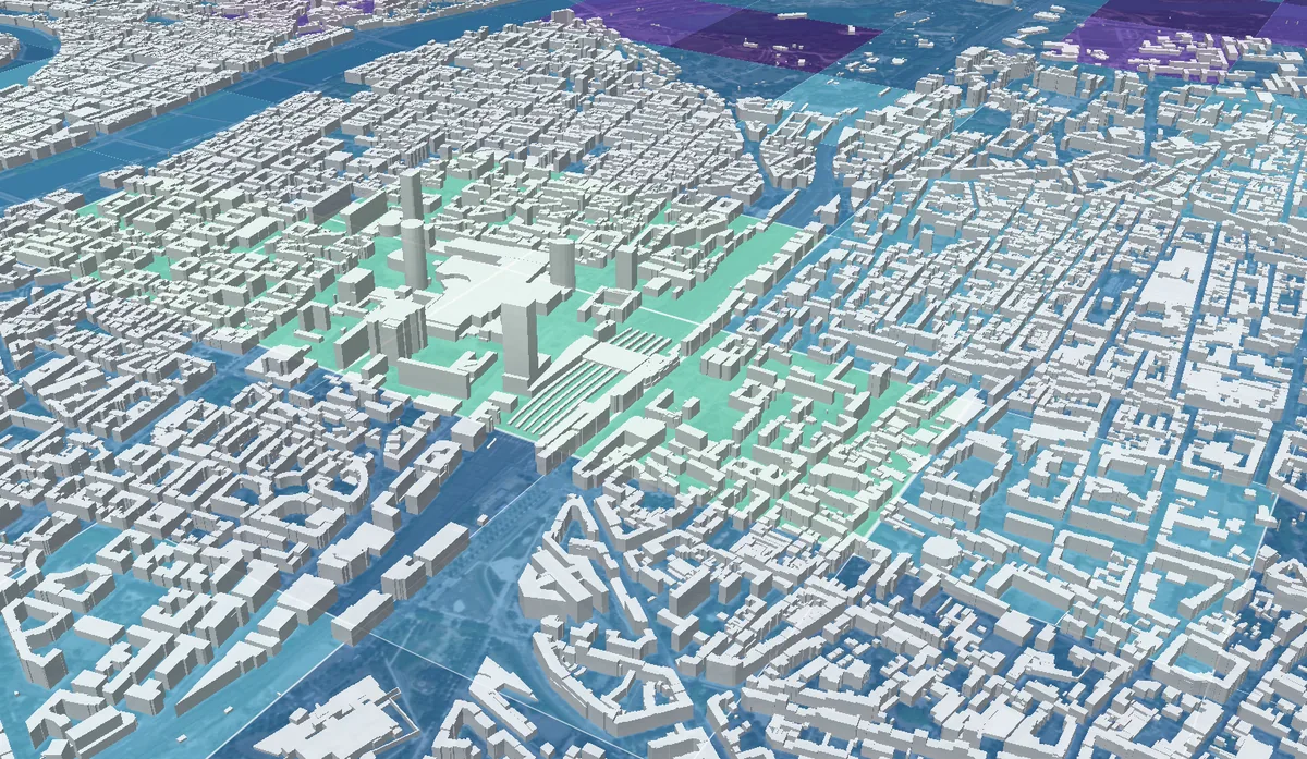
Scoring & prioritisation
A score from 0 to 100 per cell, so the high-potential zones read at a glance. Here, the urban geothermal scoring proof of concept in Lyon, 2,009 zones scored on four weighted dimensions.
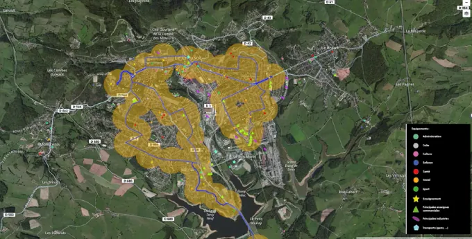
Territorial diagnostics
Population, facilities and transport network data crossed to work out which areas to serve first. Here, an urban community.
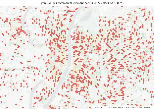
Retail & vacancy
The balance of shop openings and closures since 2022, by 150 m blocks. This map shows where the closures cluster. It does not say the high street is dead.
Frequently asked questions
A question that is not here?
Discuss this strand →30 minutes are enough to see whether, and how, working together makes sense.
Data does not remove the risk. It lets you choose which one you take.